


Voting District 0400109, Suffolk County, New York
About
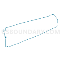
Outline

Summary
| Unique Area Identifier | 637751 |
| Name | Voting District 0400109 |
| County | Suffolk County |
| State | New York |
| Area (square miles) | 3.65 |
| Land Area (square miles) | 3.65 |
| Water Area (square miles) | 0.00 |
| % of Land Area | 100.00 |
| % of Water Area | 0.00 |
| Latitude of the Internal Point | 40.76876180 |
| Longtitude of the Internal Point | -73.42427760 |
Maps


Graphs
Select a template below for downloading or customizing gragh for Voting District 0400109, Suffolk County, New York


Neighbors
Neighoring Voting District (by Name) Neighboring Voting District on the Map
- Voting District 0100028, Suffolk County, NY
- Voting District 0100031, Suffolk County, NY
- Voting District 0100048, Suffolk County, NY
- Voting District 0400101, Suffolk County, NY
- Voting District 0400151, Suffolk County, NY
- Voting District 0400171, Suffolk County, NY
- Voting District 0400178, Suffolk County, NY
- Voting District 0513047, Nassau County, NY
- Voting District 0513056, Nassau County, NY
- Voting District 0513059, Nassau County, NY
- Voting District 0513066, Nassau County, NY
Top 10 Neighboring County Subdivision (by Population) Neighboring County Subdivision on the Map
- Oyster Bay town, Nassau County, NY (293,214)
- Babylon town, Suffolk County, NY (213,603)
- Huntington town, Suffolk County, NY (203,264)
Top 10 Neighboring Place (by Population) Neighboring Place on the Map
- Plainview CDP, NY (26,217)
- Melville CDP, NY (18,985)
- Wyandanch CDP, NY (11,647)
- East Farmingdale CDP, NY (6,484)
- Old Bethpage CDP, NY (5,523)
Top 10 Neighboring Unified School District (by Population) Neighboring Unified School District on the Map
- Half Hollow Hills Central School District, NY (48,558)
- Plainview-Old Bethpage Central School District, NY (28,676)
Top 10 Neighboring State Legislative District Lower Chamber (by Population) Neighboring State Legislative District Lower Chamber on the Map
- Assembly District 10, NY (138,509)
- Assembly District 11, NY (135,087)
- Assembly District 13, NY (131,694)
Top 10 Neighboring State Legislative District Upper Chamber (by Population) Neighboring State Legislative District Upper Chamber on the Map
- State Senate District 5, NY (316,844)
- State Senate District 2, NY (314,159)
- State Senate District 4, NY (309,135)
- State Senate District 6, NY (307,789)
- State Senate District 8, NY (305,226)
Top 10 Neighboring 111th Congressional District (by Population) Neighboring 111th Congressional District on the Map
Top 10 Neighboring Census Tract (by Population) Neighboring Census Tract on the Map
- Census Tract 1122.06, Suffolk County, NY (8,271)
- Census Tract 1122.14, Suffolk County, NY (7,003)
- Census Tract 5201, Nassau County, NY (5,524)
- Census Tract 5197.02, Nassau County, NY (5,452)
- Census Tract 1223, Suffolk County, NY (4,323)
- Census Tract 1224.03, Suffolk County, NY (2,513)